Overview
Over 250 people joined us at the St. James Cathedral Centre (65 Church Street) on July 18, 2018 for a consultation on the future designs for Port Lands Flood Protection.
Julie Dabrusin, Member of Parliament for Toronto–Danforth, Peter Tabuns, Member of Provincial Parliament for Toronto-Danforth, Chris Glover, Member of Provincial Parliament for Spadina-Fort York, and Councillor Paula Fletcher (Ward 30) welcomed members of the public.
Waterfront Toronto’s SVP of Planning and Design, Chris Glaisek, began with a history of the Port Lands and an overview of the challenges and opportunities in the Port Lands. VP of Project Delivery, Julius Gombos, then provided an update on construction progress to date and the construction schedule through the end of 2019. He also explained that the design team is considering a full vision for the area, but some parks, public spaces, roads and foot bridges aren’t funded as part of Port Lands Flood Protection – those pieces will be built in the future when development in the Port Lands begins. For a better understanding of what we’re building, explore this breakdown.
Our focus for this meeting was the design of the river valley and ecosystems, new roads and bridges.
Presenters Herb Sweeney and Matthew Urbanski from MVVA walked participants through the process of engineering an urban river park, showing the methods behind creating a meandering river, coastal marshes and wetlands. They also touched on the types of activities and amenities we’re proposing can happen in both these naturalized greenspaces and the additional 11 hectares of parkland we’re building (Promontory Park South and River Park).
Presenter James Roche from DTAH provided an update on designs for three new roads: Cherry and Commissioners Streets and Don Roadway. Each will serve a different function and have a different character.
Presenter Mike Meschino from Entuitive provided an update on design for three new bridges: Cherry North and South and Commissioners. He pointed out that a separate LRT bridge across Cherry North is funded as part of this project, while LRT bridges on Cherry South and Commissioners would come later as development begins and demand in those areas increases.
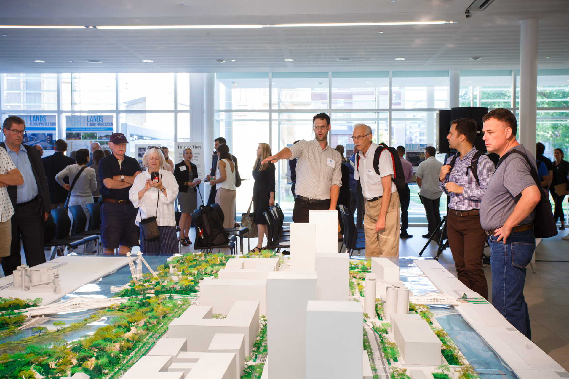 MVVA’s large model of our future river and parks captured everyone’s imagination. See videos of the model being assembled (over 12 hours!) and the crowd exploring the model.
Those who joined us participated in a variety of activities to help us learn about their aspirations for the new river and natural green spaces, roads and public realm and bridges we’re building.
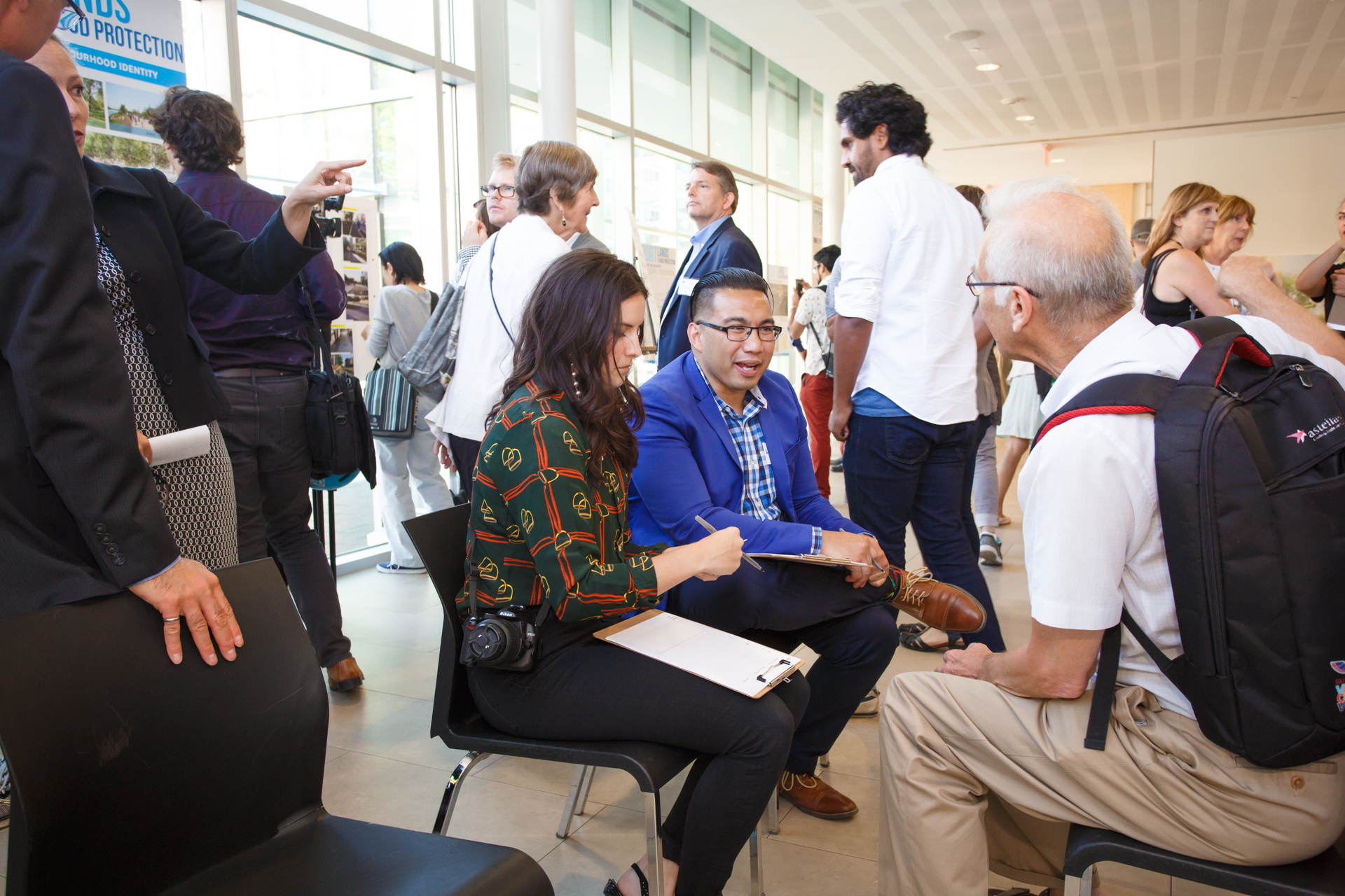
Journey Mapping: Participants were paired with a member of the project team and asked to talk about their experience travelling to a park. This helps the team designing the network of trails and paths, roads and bridges understand the challenges people face when accessing public parks and spaces.
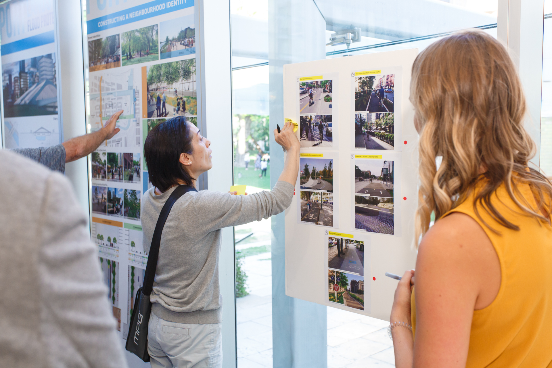
This or That: Participants were asked to choose between two different methods for separating different modes of traffic (cyclists, pedestrians, drivers) as well as different visual and physical cues for transition zones where two modes of traffic intersect. This helps the team understand which safety features people find most effective.
If you missed the event and would like to give us your feedback, you can play “this or that” online. Follow this link to complete a quick survey. We’re accepting feedback until August 31, 2018.
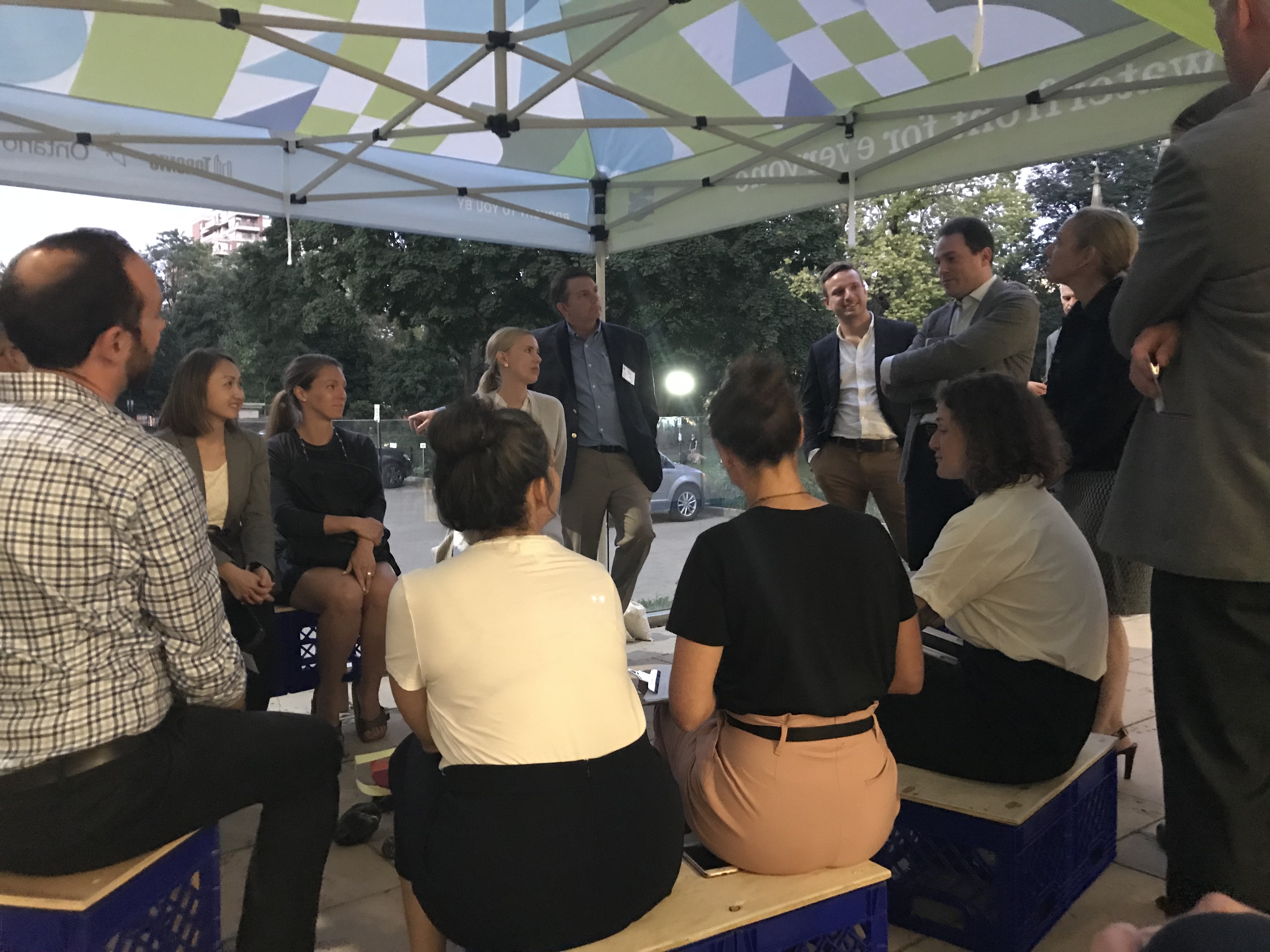 Story Circle: Participants were asked to join our circle and talk to each other about an experience where they felt connected with nature. This helps us better understand how people want to connect with nature in the city.
Missed the meeting but have a story you’d like to share? We want to hear it. Send us your story and, if you’d like, include a photo.
In addition to these activities, we also displayed material on the river and ecosystem, parks, roads and bridges, as well as the history of the Port Lands. All display material and presentations are available here:
• Waterfront Toronto introduction presentation deck
• Design team presentation deck
• Proposed Programming Display Panels, Roads & Bridges
• Proposed Programming Display Panels, Urban River Park
• Port Lands 101
• Time Line of the Port Lands
A video of the presentation and Q&A portion of the event is available here.
A summary of the feedback we received will soon be publicly available