your question
What Does This Work Do For Our City?
Our Answer
The Port Lands Flood Protection Project will improve quality of life, bring nature back to an underused industrial site and better protect our neighbourhoods from extreme weather conditions. Some of the reasons for doing this work include:
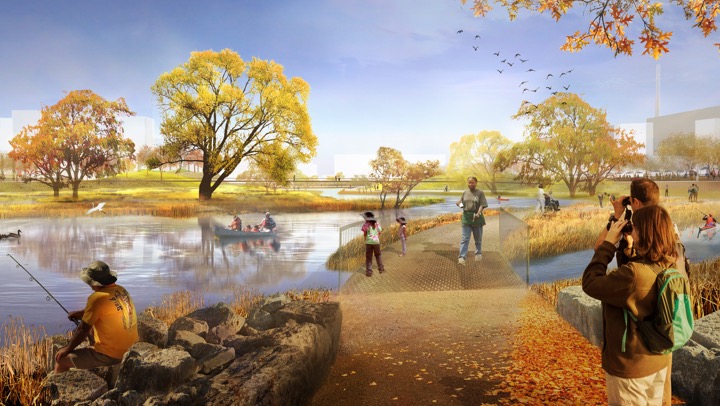
More waterfront for everyone. This work creates a stronger connection between land and lake so that anyone who visits the Port Lands can enjoy a vast stretch of waterfront.
More nature and greenspace. The creation of the new river mouth will connect the Port Lands to a 195-hectare network of parks nestled within the ravine system that runs through Corktown Common past the Brick Works to Pottery Road.
Protection from the affects of climate change. Extreme weather events are on the rise and this work will protect 240 hectares of land within the southeastern downtown from flooding.
Improving the natural environment. We are cleaning contaminated soil and building new parks, wetlands and marshes. Our work on the river will also create a healthier and more natural outlet for the Don River and a new home for fish, birds and other animals.
More jobs and economic growth. This project will contribute over $4 billion to the Canadian economy.
Enabling new neighbourhoods and more housing. Unlocking the Port Lands for revitalization will help address the critical need for housing as part of a development of new communities next to Toronto’s downtown core that are connected by transit and cycling networks. A new island community will emerge as a result of this project. Temporarily called “Villiers Island,” this is envisioned as an innovative model for a climate positive community. As planned, it will deliver approximately 9,000 new housing units, including as many as 2,700 affordable rental units, helping to address a critical need for housing in the city.
A brighter future. When this project is complete, the Port Lands will finally become a place where our city can grow and evolve to better meet the changing needs of the people who live here.

Article
Benefits of Flood Protection
Discover how this project makes Toronto a healthier, more resilient city.
Read more
Photo Gallery
Before and After: Port Lands Flood Protection
Wonder what the construction in the Port Lands will create? Have a look at what is currently in the Port Lands and what we imagine the space to be used for after.
View gallery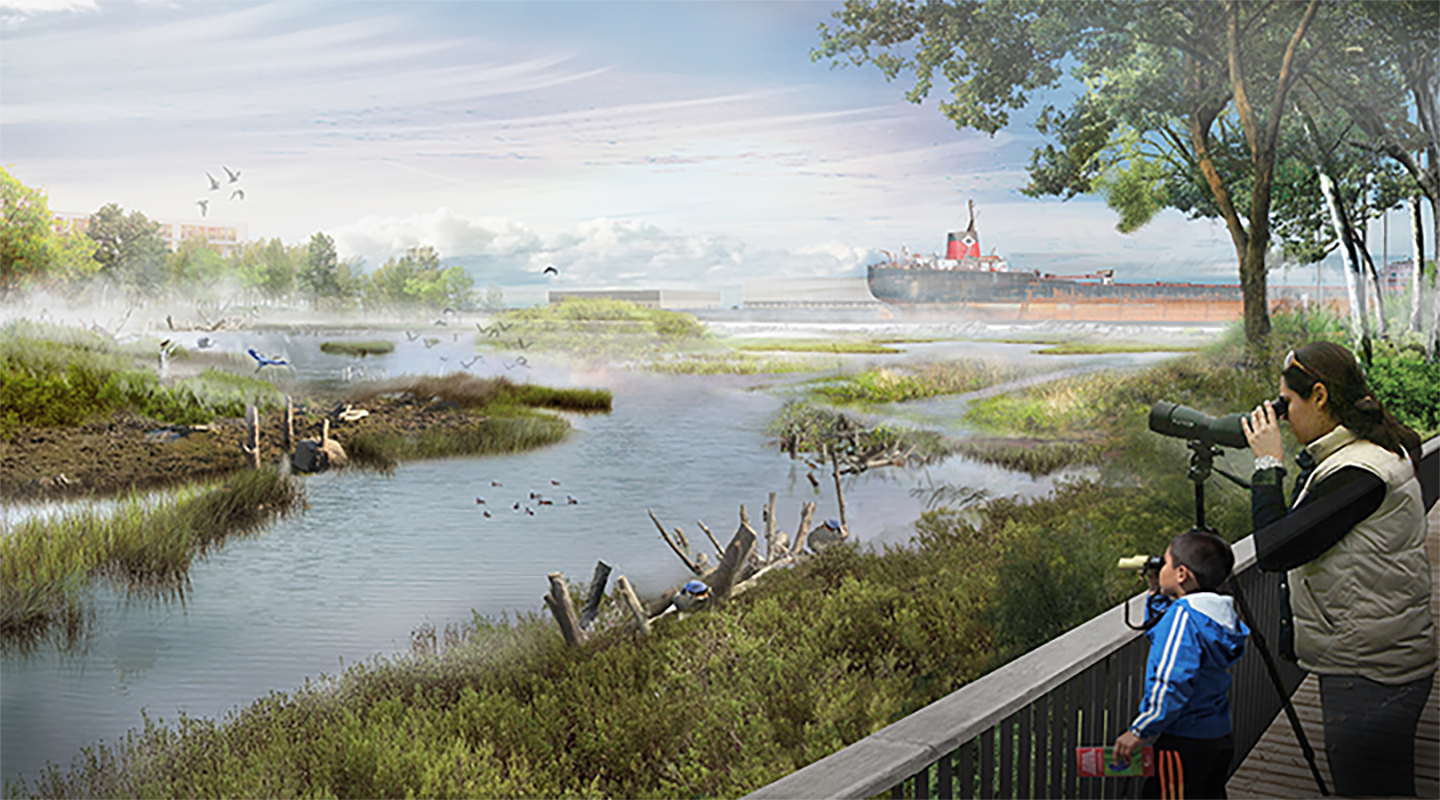
Article
Bringing Natural Back
The Cherry Street Stormwater and Lakefilling Project will bring the Port Lands closer to its natural state as a hub for wildlife and aquatic species.
Read more