your question
What is the port lands flood protection project?
Our Answer
The Port Lands Flood Protection Project is about taking action to protect Toronto’s southeastern downtown area. Right now, in an extreme weather event, floodwaters from the Don River would overwhelm portions of the Port Lands, South Riverdale and Leslieville. Our plan is to reconnect the Don River to Lake Ontario by creating a naturalized river mouth. To do this we are embarking on one of the biggest infrastructure projects in Toronto’s history.
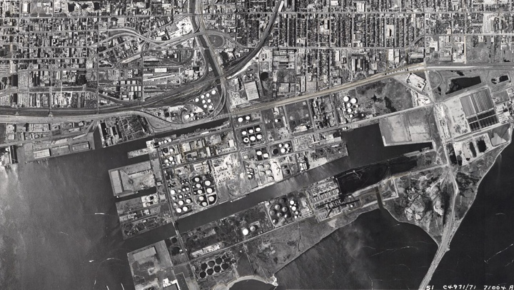
Toronto’s Port Lands is considered one of the largest underdeveloped stretches of downtown waterfront in North America. Up until now we have been unable to make this industrial area a thriving part of our city because portions are at risk of flooding and the soil is contaminated.
We are creating two new outlets for the existing river so that floodwaters can run off into the inner harbour instead of damaging the surrounding neighbourhoods. This work involves digging a kilometer-long river valley, which ends in a new mouth that we are constructing for the Don River. We are also cleaning up polluted land at the same time as we build new roads, bridges, utilities and public trails. When this work is finally complete, we will have created 25 hectares of publicly accessible greenspace and parkland . This project is the beginning of a once-in-a-lifetime opportunity to transform the face of Toronto.
History of the Project
Healing the Don River has been an active dream since the 1980s when a citizens group launched the Task Force to Bring Back the Don in 1989. One of their first projects was to create a book called Bringing Back the Don. Published in 1991 by the City of Toronto, the book sketched a vision for how the River could be revived. Plans to revitalize the mouth of the Don River and flood protect the surrounding area became formally known as the Don Mouth Naturalization and Port Lands Flood Protection Project, a name that was later shortened to the Port Lands Flood Protection Project.
Planning initiatives for the Port Lands have been underway for over a decade. As part of the long-term planning process, Waterfront Toronto, the City of Toronto and the Toronto Region Conservation (TRCA) have worked on a number of initiatives and studies, including: the Don Mouth Naturalization and Port Lands Flood Protection Environmental Assessment (DMNP EA), the Lower Don Lands Master Plan Environmental Assessment, precinct planning for Villiers Island (now called Ookwemin Minising), the Film Studio District, the Port Lands and South of Eastern Transportation Master Plan EA and the Port Lands Planning Framework (PLPF). These planning documents will provide direction around how to transform the Port Lands into a waterfront community with ties and connections to the city.
Here is a timeline of Port Lands Flood Protection project
- In 2005, we began the process to establish the Terms of Reference process for the Don Mouth Naturalization and Port Lands Flood Protection Environmental Assessment (DMNP EA). This set the conditions of the EA.
- In September 2006, the Ontario Ministry of Environment and Climate Change approved the Terms of Reference for the DMNP EA and the study formally began.
- In 2007, Waterfront Toronto launched an international design competition to create a concept design that included habitat creation and flood protection, and a comprehensive plan for addressing urban design, transportation, naturalization, sustainability and other ecological issues. This involved an extensive public consultation process and a week-long public exhibition. The winning design is by Michael Van Valkenburgh Associates. This provided the framework for what would become the preferred alternative through the DMNP EA.
- In 2011, Toronto City Council adopted what would later be called the Port Lands Acceleration Initiative (PLAI). The goal of the initiative was to retain the core ideas behind the DMNP EA while developing strategies for accelerating revitalization in the Port Lands. This plan was refined in 2012 and became known as PLAI 2, which included the Port Lands Planning Framework, Villiers Island Precinct Plan and Port Lands and South of Eastern Transportation and Servicing Master Plan Environmental Assessment.
- In 2014, the Lower Don Lands Master Plan Environmental Assessment was approved.
- In 2015, the Don Mouth Naturalization and Port Lands Flood Protection Environmental Assessment was approved.
- In May 2015, work began on the Due Diligence Report for Port Lands Flood Protection.
- In October 2016, the Due Diligence Report for the Port Lands Flood Protection Project was completed, providing governments with additional assurance on the cost of this project, ways to mitigate the risks, and a strategy and schedule for executing the project.
- In June 2017, $1.25 billion in municipal, provincial and federal funding was awarded to the Port Lands Flood Protection Project.
- In October 2017, the Port Lands Planning Framework and Villiers Island Precinct Plan were adopted by Toronto City Council.
- Construction on the project began in December 2017. This ambitious undertaking is slated for completion in 2025.
What’s Next?
Once we complete the project in 2025, a new river valley will run through the Port Lands, creating a new island: Ookwemin Minising. The natural landscape of the river valley will become home to diverse plants and wildlife.
With the threat of flooding removed, development can begin on new places to live, work and play in the Port Lands. The approved Villiers Island Precinct Plan will guide development of a new mixed-use community. The next area to be planned is the McLeary District, part of the Film Studio District east of Don Roadway.

Article
History of the Port Lands
Explore the Natural and Industrial History of the Port Lands.
Read more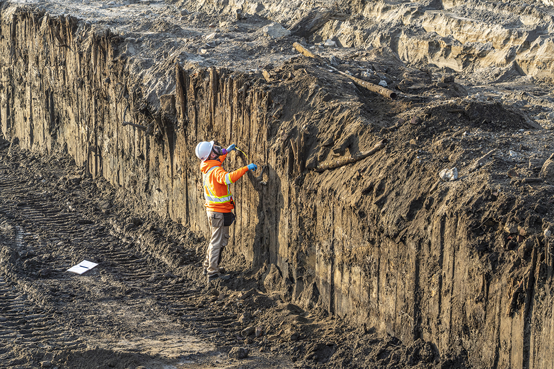
Article
Excavating a late 1800s breakwater
Explore a remnant of the past that was unearthed during excavation.
Read more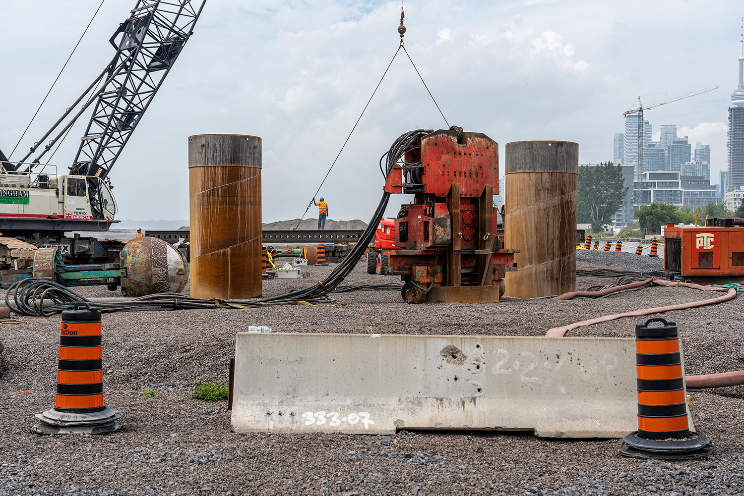
Article
Photographs of the Changing Port Lands
View the collection of photographs documenting the transformation in the Port Lands over the next five years.
View Images