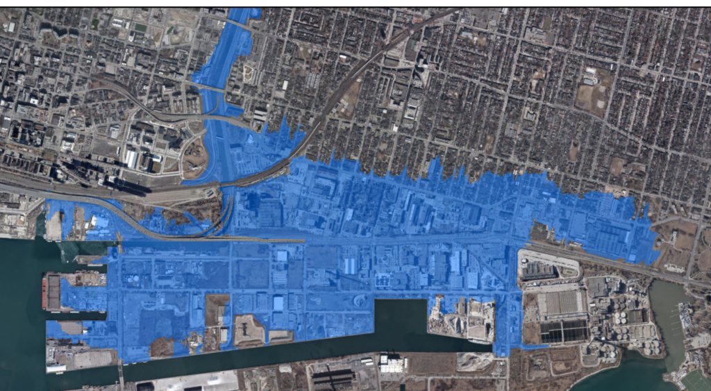
Port Lands Flood Protection is about protecting against flooding from the Don River, which is separate from possible effects of high lake levels. When we began detailed design, we based our flood modelling on provincial guidelines to protect the Port Lands and surrounding area from flooding in the event of a Regulatory Storm. The Province of Ontario defines a Regulatory Storm as the 1 in 100 year storm or the most severe storm to ever hit the region (whichever is the larger event). For Toronto, that is 1954’s Hurricane Hazel. Our design creates 100 per cent resiliency during a storm even larger than Hurricane Hazel. Water levels in Lake Ontario typically fluctuate by up to one metre above and below average lake levels. Because of this, we’re designing wetlands that can survive extremes of high or low water levels. The wetlands will be built at different elevations, which means if water levels go up or down, there will always be some areas available for fish, birds and other wildlife to find food and shelter. This keeps the entire system healthy. In the event of prolonged extreme weather or lack of water due to low lake levels, a monitoring plan will be in place so that we can adapt the system. Hydraulic modelling indicates that that the forecasted increases in the 100-year high lake level will not significantly impact the design flood levels from the Don River.
So, if it doesn’t change the flood risk from the Don River, what impact does higher lake levels have? The Port Lands, in their existing condition, would be at risk from rising lake levels just like elsewhere on the waterfront – unrelated to its location in the Don River’s watershed. Our initial designs for infrastructure like dock walls and underground utilities were done to accommodate the original 100-year high lake level condition of 75.7m. However, due to the record high lake levels that were experienced in 2017 and 2019, the 100-year high lake level has been reforecasted twice since the beginning of the project. The first time the 100-year lake level was adjusted, in summer 2019, Waterfront Toronto adjusted our designs to reflect that new high lake condition. After TRCA’s most recent recommendation that these numbers again be increased to 76.2m, Waterfront Toronto is now exploring what changes to the design are necessary or possible, in consultation with our government partners. We are now reviewing any remaining recommendations and will provide updates when we have that information.
It’s important to clarify that higher lake levels would not result in catastrophic lake flooding on the Island. As part of PLFP, those areas will be raised well above high lake levels to address the flood risk from the Don River. The main challenge within the Port Lands Flood Protection project area will be localized run-off and ponding from those future urban lands if lake levels are very high.